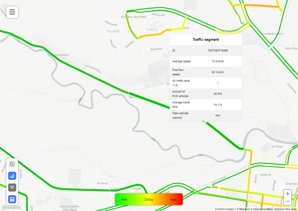
FeatureMap layers are the primary way to visualize feature-based data. Each feature is represented as a GeoJson feature (usually a line or polygon). That can be selected or deselected and shows further details when hovered over.
In addition to Common layer settings, the VTFeatureMap layer type has additional settings that are shared with the FeatureMap layer type settings.
The difference between the FeatureMap and VTFeatureMap layer types is in how the GeoJson features are rendered to the end-user. In the case of VTFeatureMap, the features are delivered to the client in the form of vector tiles and rendered by the client. This significantly improves the performance of the application, especially for projects with a large number of features.