InnoConnect delivers a traffic safety project in Ethiopia, named Safer Roads in Ethiopia through Identification of High-risk Locations. The project has been supported from the United Nations Development Programme (Czech-UNDP Challenge Fund) with the financial support of the Ministry of Foreign Affairs of the Czech Republic.
After several months of data processing and development work, we’ve released a first public prototype of the Traffic Crash Analytical Map of Addis Ababa, Ethiopia, available at https://glayer.innoconnect.net/ethiopia_accidents. The map allows exploratory analysis of traffic crashes. The current prototype contains information about 350 fatal crashes during a period of one year
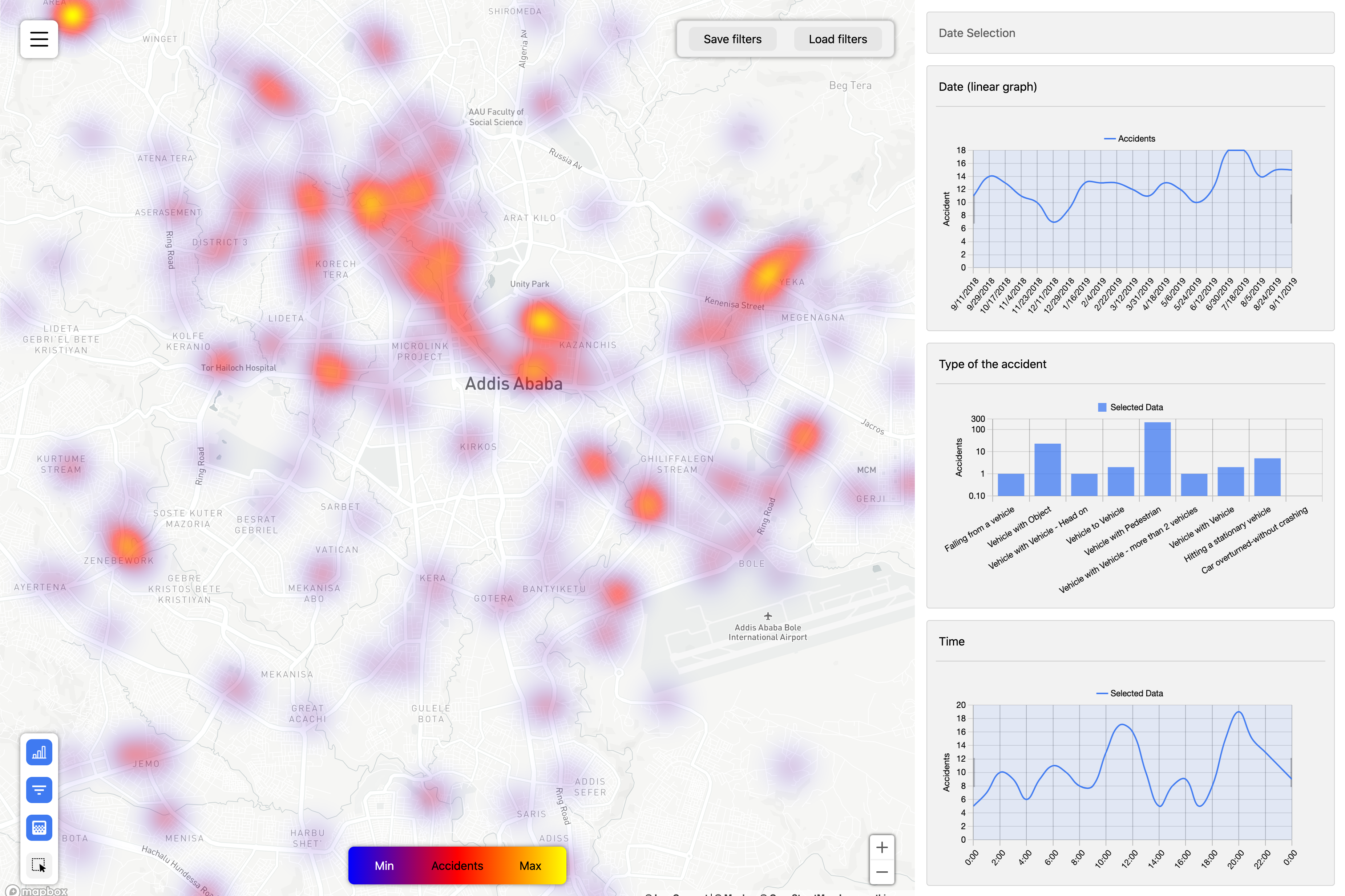
With the Traffic Crash Analytical Map of Addis Ababa, the city decision makers at different levels of governance can gain data driven insights to better design, implement and evaluate measures aimed at reducing fatal and severe road accidents. The solution will allow to perform a deep analysis of traffic safety to identify high-risk locations, to get in-depth knowledge of factors that increase risk of severe accidents, and to visualise specific information about single accidents.
How to interact with the web app:
- The analytical map allows to filter traffic accidents by zooming and moving the map and also by clicking / selecting in the charts in the right panel. Map and charts are interconnected and instantly updated when applying a selection.
- Further settings (such as map layers, dark mode etc) and export of data is available in the left menu .
- At the bottom left, you can activate the ‘polygon’ filter which allows to manually draw an area for your analysis.
- For the moment the app uses the Gregorian calendar in the charts on the right side (we work on a solution to display the Ethiopian calendar as well)
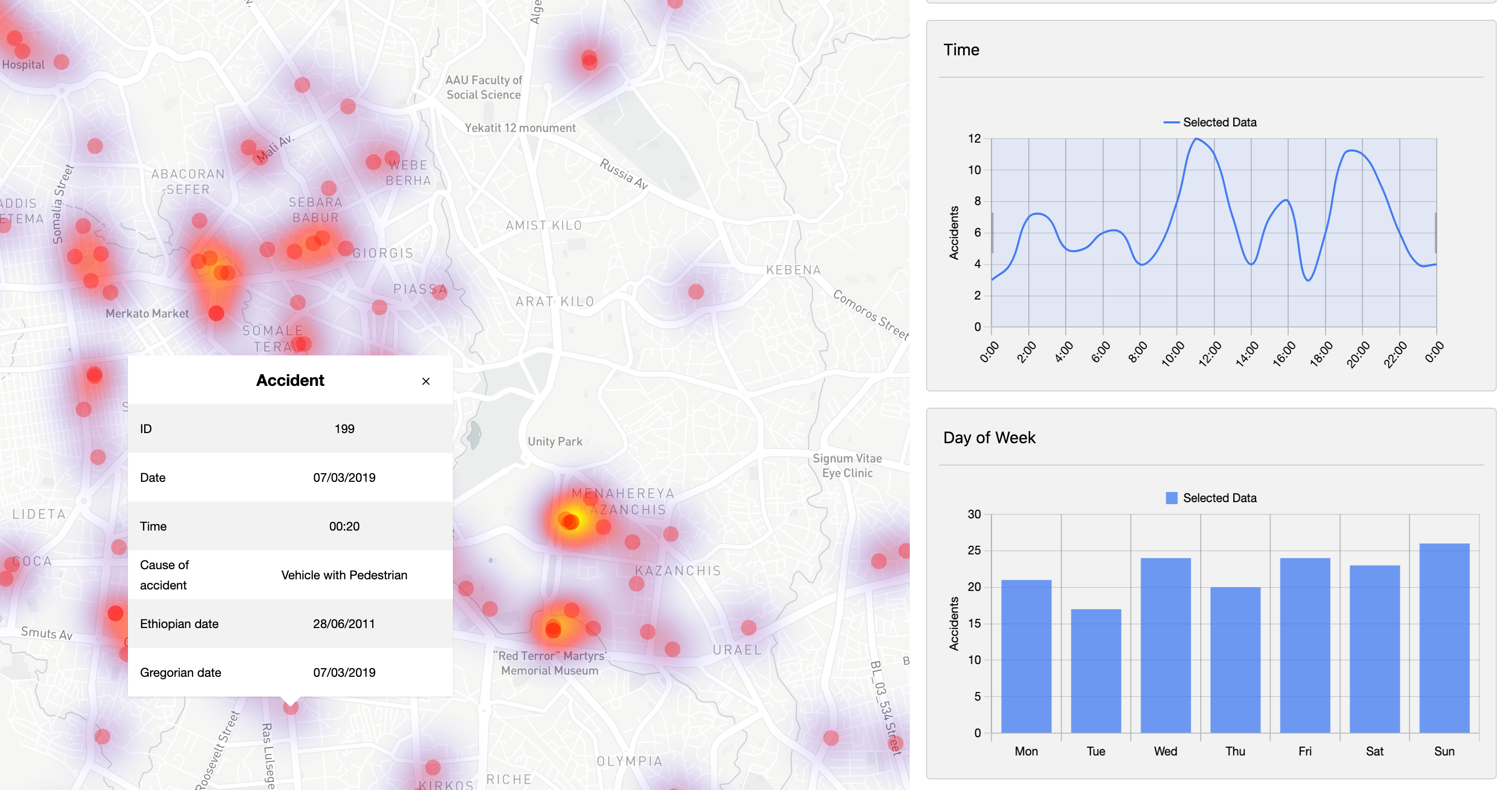
- When zooming closer, you will see points of single accident and can view details of single accidents, such as date + time and cause of the accident.
See this video on how to work with the app if needed.
The final version of the map is scheduled for September and will contain more traffic crash data covering longer period.