We have recently released to public the first prototype of FlowMap – the Analytical Map of Traffic in Pilsen. The map is accessible from the Pilsen Mobility dashboard that links together multiple analytical maps related to mobility in Pilsen at https://innoconnect.net/mobilita-v-plzni/
The Traffic Map, developed with the innovative GLayer technology, provides information on traffic in Pilsen, Czech Republic. Users can consult traffic information on the speed and amount of vehicles in a real-time dashboard or through a historical view with interactive charts and date selection. Data is provided in real time from connected cars (floating car data provided by ŘSD) and traffic lights sensors (provided by the City of Pilsen).
The map features two views on traffic:
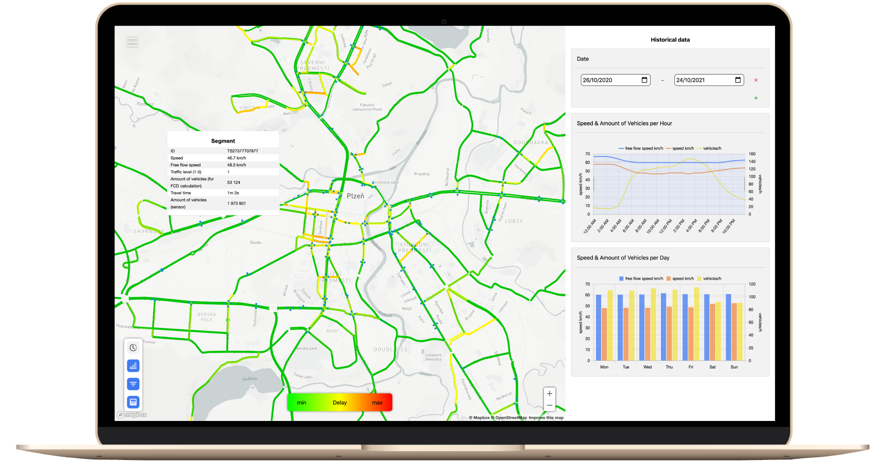
- historical view with powerful data filtering functionalities, allowing to dive deep in the traffic data from the past year
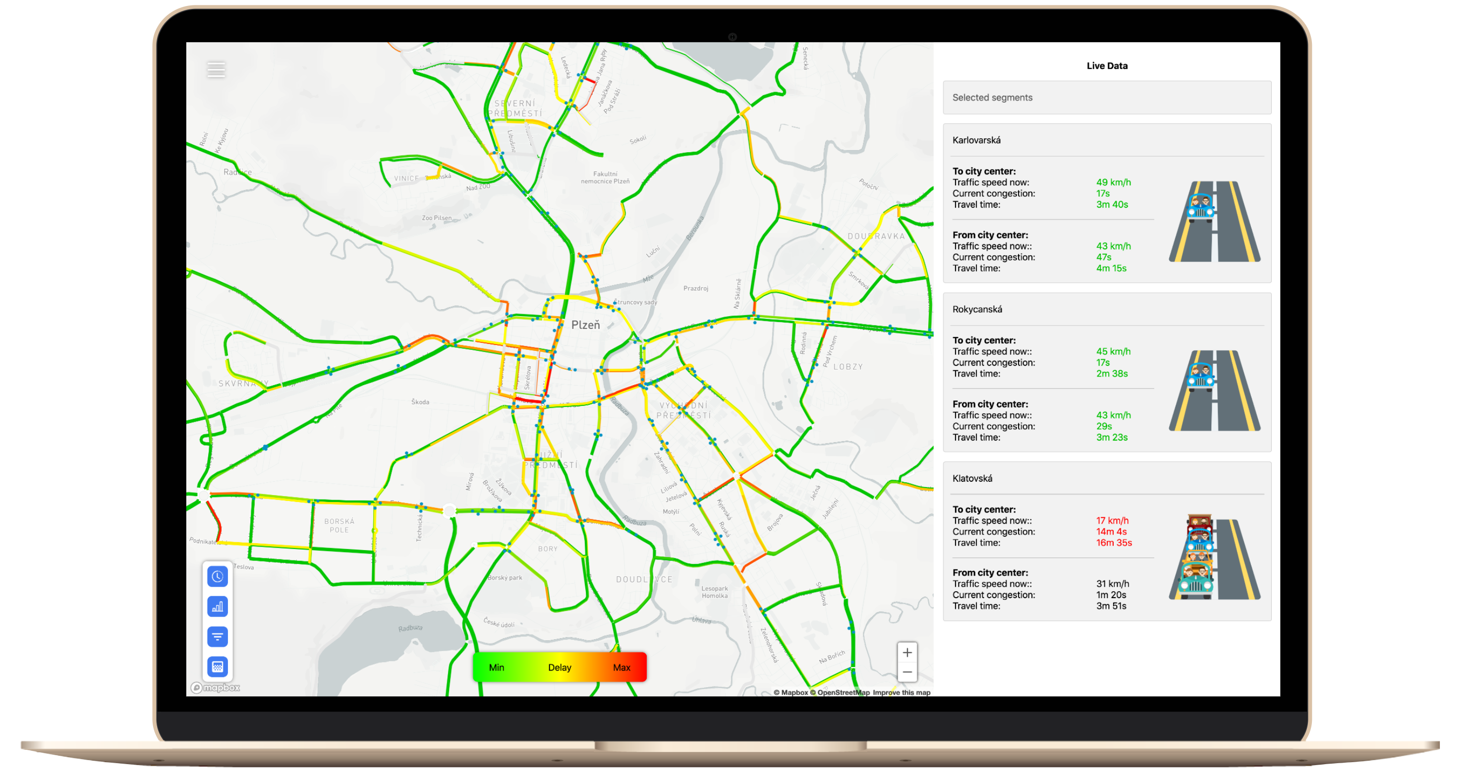
- live traffic dashboard that informs about the current traffic flow speed in the city, displays current speed and delay on the main transit routes through the city, and allows to make your own selection of street segments for deeper real-time insights.
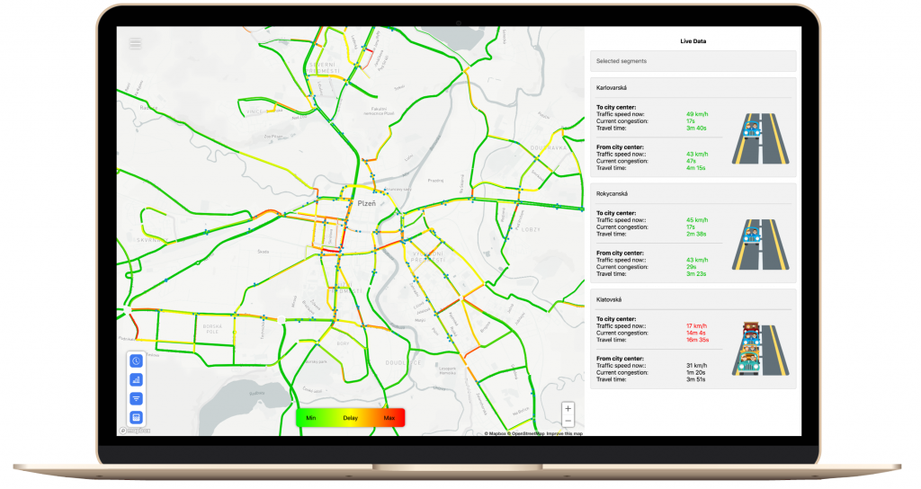
Live traffic dashboard 
historical traffic data analysis
The development of FlowMap was co-financed by the BOWI project (H2020), thanks for your support!